One of the most prevalent use cases in the evolving world of IoT is the ability to track a moving object or simply locate a fixed object within a large fleet. This use case requires objects to combine positioning and wireless communication technologies in a cost and power efficient manner. This very broad and general use case can be analyzed into an interesting variety of specific scenarios, each with its own requirements and relevant technologies. As both of these functions, communication and positioning, become cheaper and more accessible, the number of uses and applications continues to climb. In this post, I would like to take a look at some of these scenarios, and take a peek at the solutions that are available for each one.
Cargo Shipping: GNSS with cellular

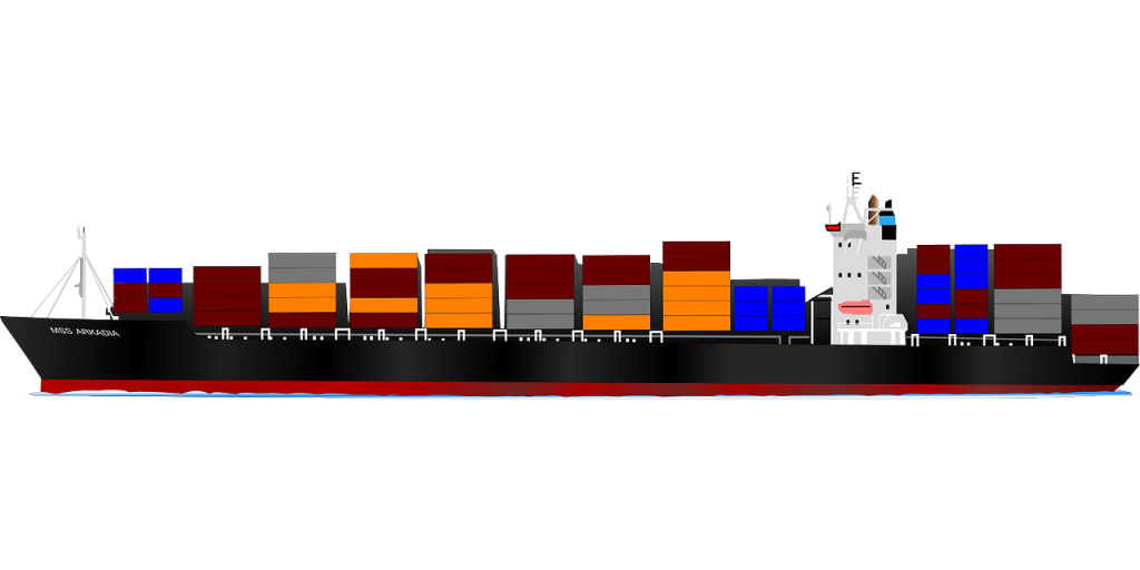
Figure 1. Shipping cargo across the globe (source: Pixabay)
Asset tracking is an enormous field with many different applications. Starting from the largest scale, there is worldwide or nationwide shipping that requires global positioning to track packages or other cargo. These can be shipped by land, sea or air, and therefore are not always covered by cellular networks. In these cases, a Global Navigation Satellite System (GNSS) is required to determine the location of the asset. The four major systems covering the globe are GPS, GLONASS, Galileo and BeiDou deployed or to be deployed in the near future by the USA, Russia, the EU and China, respectively. Each one of these systems has slightly varying coverage, and therefore it is advantageous to have access to all of the systems, for optimal tracking. Although they all use similar satellite technology, each one has its own receiver algorithm, making a software defined approach much more attractive, as opposed to embedding a hardware modem for each satellite system. The data transmission in this scenario would be handled by cellular communication. Where LTE is available, dedicated MTC versions Cat-1, Cat-M and NB-IoT can be used depending on the required data rate. A complete solution must also support 3G and 2G technology as fallbacks, for places that do not possess LTE coverage.
Geo-fencing: OTDOA and GNSS with cellular
At the scale of the city or the neighborhood, an interesting use-case is Geo-fencing. This is the practice of establishing a virtual boundary using positioning technology, and tracking a device relative to the boundary. If the tracked device breaks the perimeter, a notification is triggered. The notification could include a text message, email or other alert depending on the application. This technology is used by parents to verify the whereabouts and safety of their children. An additional use for Geo-fencing is to keep track of personal belongings, like bicycles. Another rapidly growing market of positioning and monitoring technology is for household pets. A recent article on wareable.com gives a list of the best pet wearables, which, in addition to location tracking, offer monitoring of vitals and activity and even optional cameras to capture an interesting new perspective. These applications would normally use cellular communication and either GNSS, OTDOA or a combination of both for positioning. LTE-OTDOA is the LTE technology that allows to locate precisely a network registered device through base-station triangulation. LTE has improved this technology significantly compared to 2G and 3G by providing dedicated positioning reference signals (PRS) transmitted by the eNodeB in order to improve position resolution.
Package Delivery Drones and Location based advertisement
Recently, Amazon revealed its design for a delivery drone, complete with sensors and precise location awareness. Upon arrival, according to Amazon, the drone drops off the package and notifies the customer through an application on a handheld device. This type of use-case probably incorporates a combination of GNSS and OTDOA positioning as well cellular LTE communication for data transfer. For drone delivery in dense urban settings, OTDOA is especially essential, because the tall buildings can interfere with satellite reception for the GNSS and hinder accuracy. In addition to these necessary features, a drone of that type would definitely be equipped with many sensors to identify and avoid hazards and obstacles along the way.

Figure 2. Shopping in Shibuya, Tokyo (Source: Pixabay)
For advertisers, location information is invaluable, as it helps pinpoint potential customers who are in the vicinity of a specific business. On Google’s support website, you can read how ads are matched to geographic locations, demonstrating how important this aspect is. For this use of positioning, it is crucial to avoid draining the device battery, otherwise the users would be prone to disabling or removing the feature.
Indoor tracking: Wi-Fi or Bluetooth beacons
On the scale of a specific building, we arrive at the use-case of indoor tracking. This is especially relevant in a venue like a hotel, which has a lot of expensive equipment spread out in a large building. In this scenario, satellites are usually blocked by the structure, and in some areas cellular coverage may not be fully available or precise enough to pinpoint the exact location of a piece of equipment. In this case, the relevant technology would be either Wi-Fi or Bluetooth-enabled beacons to determine the location. The data transfer in this case could be performed via Wi-Fi 802.11n or 802.11ah if extended coverage is required. As a fallback if there is no full Wi-Fi coverage, then cellular communication will be used.

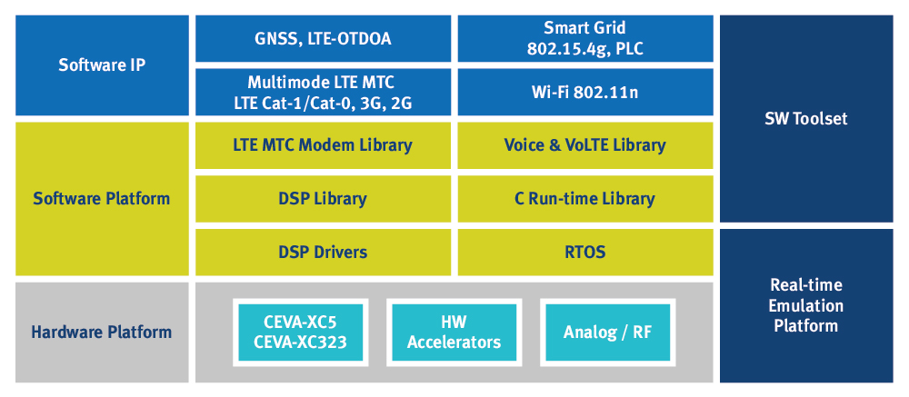
Figure 3. CEVA Dragonfly HW/SW platform (Source: Ceva)
What we’ve seen is that there is a constantly growing and evolving market of positioning and communication applications. Different technologies are required to address the wide variety of scale and speed, from fast-moving worldwide transit to fixed-location monitoring or indoor tracking. At CEVA, we realize that the only way to tackle the wide variety of use-cases and scenarios is by using a programmable, software defined solution. Thus, we can take into consideration all the different use-cases and supply one platform to handle all the cases. We have taken all these different scenarios into account in the development of our CEVA-Dragonfly platform. The platform is specifically designed for concurrent multi-mode communication IoT wireless applications, supporting existing and emerging LTE MTC releases (Cat-1, Cat-0, Cat-M), LPWA standards (e.g. NB-IoT, EC-GPRS, LoRa, Sigfox, Ingenu), in addition to Wi-Fi 802.11n, GNSS and LTE-OTDOA. Such a platform also allows HW economies of scale as the same SoC can serve the two extreme use cases of dense urban outdoor tracking based on GNSS and LTE-OTDOA with LTE Cat-M and NB-IoT transmission as well as the indoor use case based on BT and Wi-Fi beacons with 802.11n or 802.11ah transmission. Using a programmable solution also ensures that future updates and additions can be added and tweaked remotely, allowing for fast time-to-market while keeping the solution future-proof for the long term.
Click here to watch CEVA’s webinar about Machine Type Communication – How To Design a LTE-Based M2M Asset Tracker SoC.

